
Just over 13 months ago our boys' dearest friend, Will, was tragically killed in an avalanche. At the time it was too shocking and too painful to write about and, although the shock is waning his loss is still keenly felt by us all. The boys had always wondered if it was possible to walk from the Lizard (England's southernmost point) to Land's End (it's most south-westerly point) on the coastal path, in a day and had planned to find out!
In his memory the first "Will Walk" was completed on March 23rd last year when 5 friends of Will's (including our boys) proved that it could, indeed, be done (albeit with some traversing on roads towards the end when it was dark and just too dangerous to continue on the coastal path). This was an extraordinary feat - on the map it's about 44 miles but in reality it's considerably more as you battle up and down the various coves and harbours en route.
Today would have been Will's 20th birthday so the second "Will's Walk" was held on Saturday and, with both our boys away, Matt and I decided to uphold the family tradition (and give ourselves a massive challenge) and attempt to walk it over two days. We may be stupid but we certainly aren't stupid enough to think we could even begin to complete it in a day! The Truro College students set off on Saturday morning. We, however, set off on Friday morning on a fine but blustery day:

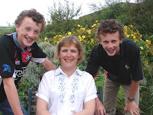
Here we are with Will's parents contemplating the enormous distance we are about to attempt (Land's End isn't even visible!):

Kynance Cove:

Down the Lizard - this, it transpired, was the easiest bit of the entire walk so we were lulled into a false sense of security!:

If you look very carefully into the background of this picture you can just about make out the Land's End peninsula:

Here, too, you can just make out Land's End in the far distance:

Coming up from Kynance Cove - you can see the path starting to go up and down, reality is setting in!:

a "wtf" moment!:

4.5 miles down, only 40 to go ....:

Approaching Mullion Cove:

Mullion Harbour:

Poldu Monument:

and what it says:

the incredibly battered postbox in the bridge at Poldu Cove:

Approaching Church Cove:


At this point we could look right back past Mullion to Lizard Point:

Approaching Loe Bar and Porthleven - starting to get very blustery here and the path is rather too close to the edge for comfort!:

Coming down to Loe Bar, where waterproof trousers had to be put on rather hastily (not easy in a howling gale!):


On Loe Bar, looking up The Loe:

Porthleven Harbour - scene of those appalling storms a few weeks ago:

Across the other side of the harbour some storm damage is clearly visible:

Rain approaching Lizard Point:

Looking back to Porthleven - the path can clearly be seen winding up and down - this was one of the hardest parts of the walk:

The mine stack at Trewavas - you can clearly see how narrow the path is, which also made it hard going (especially when we were caught by gusts of wind):

Imagine mining here - and, indeed, building these mine buildings!:


As can be seen from this last photo, the sun was going down and we cracked on as far as Kenneggy, when the rain started lashing and it was well and truly dark so we headed up the main road where we got a lift into Marazion. We were drenched and freezing cold and very grateful for a hot shower and warm meal.
As we left the coast path and headed up to the road there was an almighty crack of thunder overhead. We like to think it was Will telling us we'd made the right decision!
Tomorrow - Marazion-Land's End .......................
No comments:
Post a Comment